|
|
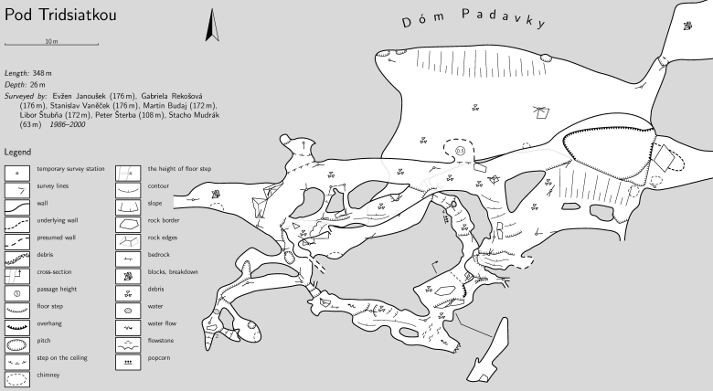
2D mapsThe output maps are very flexible – the map is not only up-to-date, reflecting all changes in centreline, but in addition you may change scale, symbol set and format: either one-sheet map or multi-page atlas with cross references and hyperlinks. Maps may contain the whole cave or the selected part(s) only. When displaying complicated multilevel systems, you may choose between displaying all levels opaque or transparent, optionally coloured by depth; selected levels only; or selected levels with the preview of some levels below (filled grey) and above (stroked as thin outline). Therion can process ground plan with cross sections, elevation and extended elevation maps. You may choose to hide some groups of symbols, so with one setting you can get simple map containing passage outline and centreline only; or you may instruct Therion to highlight all symbols denoting possible continuation with red colour... All variants are generated from one source only by changing processing options. Draw map once and get dozens different customized maps on the output. Zoomable map of the Great Canyon Cave (Velika Klisura, Gryka e Madhe) Cave in Kosovo. The map of Padavka Chamber. The legend (list of surveyors, used map symbols) is generated automatically. You may download the map or atlas in the PDF format, or the sources.
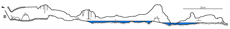
 Extended elevation of the Rabbit cave:
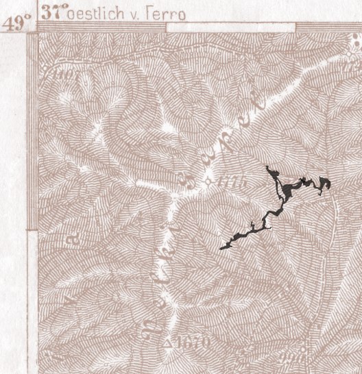
 Therion may align topographical map with the cave. In this example Therion was instructed to omit all map symbols and display only the filled passage outlines.
 |